Maps
As the second-largest landowner in the state, we rely on maps. A lot.
Our Geographic Information System (GIS) is publicly available and provides a catalog of:
- All surface trust land (2.8 million acres)
- All trust mineral estate (4 million acres)
- Ownership records for all trust surface land and mineral estate
- All current lease records on trust assets
- And more!
Accommodation statement: The State of Colorado is committed to providing equitable access to our services to all Coloradans. Please contact Rachel Majich (rachel.majich@state.co.us or 720-854-3306) for personalized accessibility assistance using this page, which includes links to visual geographic representation of our data. The data is available in a text format upon request. We will contact you directly within three business days. Visit our accessibility webpage for more information and services, including AIRA, our free service for blind and low-vision users.
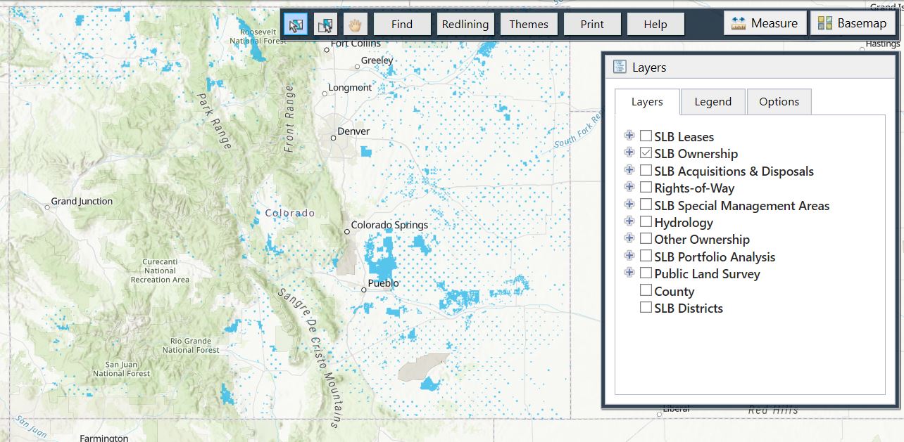
You can view the data in several ways:
(Hint: the map server is the most popular and easiest to use!)
Tips for using the map server:
- The fastest way to look up state owned land records is by using the "find" tool. You can search by Township/Range or Section, County, Lease Number, Lessee Name, Property Name or Lat/Long coordinates.
- Use the help tab for assistance.
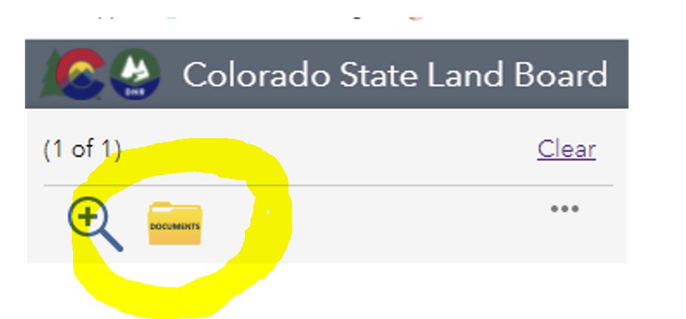
Use the map server to download a copy of a lease:
You can download a copy of a lease and any associated lease riders with three easy steps:
- Click the parcel of land on the map or enter the lease number in search box.
- Select the lease record number from the left column.
- Click the yellow folder in the top left column (pictured right).
Viola! You will see the lease record and can download it.
The following lease types are currently available for download via the map server:
- Geothermal Carbon Storage (GCS)
- Exploration Permits (EP)
- Oil & Gas (OG)
- Renewable Energy-Solar (SO)
- Renewable Energy-Wind (WI)
- Rights-of-way (ROW)
- Solid Minerals (SM)
- Tower (TOW)
- Water (WAT)
Additionally, you may also find:
- Recorded Acquisitions
- Recorded Dispositions
We are continuing to make more copies of State Land Board leases readily available to you through this map server. If you can't find what you're looking for, we're here to help! Simply fill out this form or contact us.
Still not finding what you're looking for?
It's not always as easy as 'X' marks the spot.
Questions about using these maps? Contact Shawn Logan, Planning Specialist, at shawn.logan@state.co.us..
Questions about land available for agriculture leases? Contact the pertinent district office.